
Drone Mapping and Photogrammetry: How do They Work Together?
Drone technology is advancing rapidly, aerial surveying has become more accessible and valuable than ever. Whether it’s for construction, agriculture, environmental monitoring or real estate, drone data is transforming how professionals capture, analyse and visualise the world from above. Two terms that often come up in this context are drone mapping and photogrammetry.
At Drone Discovery Ltd, we specialise in both drone mapping and photogrammetry, providing accurate, actionable data for a wide range of industries across the UK. Here’s what you need to know.
What Is Drone Mapping?
Drone mapping (also known as aerial mapping or UAV mapping) is the broader process of collecting geospatial data from the air using unmanned aerial vehicles (UAVs) equipped with various sensors. The data collected by drones is processed using advanced software to create accurate maps and three-dimensional models of the surveyed area.
Drone mapping outputs can include:
2D orthomosaics (stitched aerial images)
3D models of terrain or structures
Digital elevation and surface models (DEM/DSM)
Volume measurements
Vegetation indexes
Depending on the sensors used, drone mapping can capture imagery, thermal data, multispectral data or laser scans. This versatility makes drone mapping highly useful across diverse sectors such as mining, agriculture, construction, infrastructure inspection and environmental monitoring.
Learn more about our drone mapping and survey services and how we can help with site planning, construction and more.
What Is Photogrammetry?
Photogrammetry is a specific technique used within drone mapping. It involves capturing a series of overlapping photographs from different angles and processing them with specialised software to reconstruct accurate 2D or 3D spatial information about the terrain or objects. The word ‘photogrammetry’ literally means ‘to measure from light’: the models, orthomosaics and terrain models are used to extract meaningful data which is then analysed for a range of purposes.
Here’s how photogrammetry works in drone mapping:
The drone flies a pre-planned grid pattern, capturing high-resolution images with significant overlap (often 60-80%).
Photogrammetry software identifies common features in overlapping images and uses triangulation to calculate the 3D coordinates (x, y, z) of these points.
The result is a dense 3D point cloud, textured mesh and visually rich 3D models or orthomosaic maps containing RGB colour information.
Photogrammetry relies on good lighting and clear skies to produce high-quality images. The visual detail provided by photogrammetry, including colour and texture, is one of its strongest advantages, especially for applications where realistic representation is valuable.
Explore how our 3D photogrammetry and digital twins services can provide high-precision data tailored to your needs.
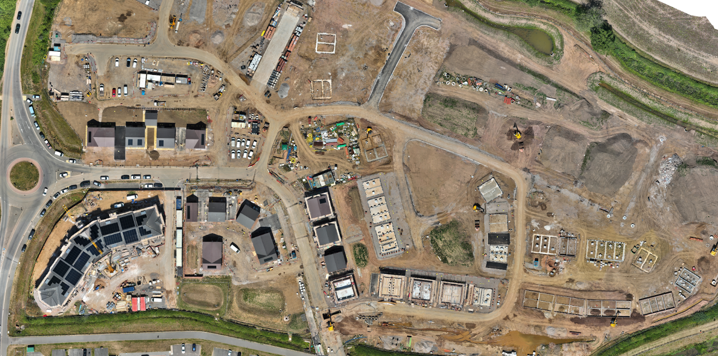
Orthomosaic image of Construction Site
How Drone Mapping and Photogrammetry Relate
Drone mapping is the broader workflow encompassing all activities from drone deployment to data processing. Photogrammetry is the image-based methodology used in many drone mapping projects for creating detailed spatial models.
Simply put: photogrammetry is one of the main ways to process drone images into accurate maps inside a drone mapping project.
Advantages of Photogrammetry in Drone Mapping
Cost-Effective: Using drones to map areas is significantly quicker and less expensive than ground based alternatives.
Visual Richness: It produces photorealistic 3D models including color and texture, ideal for inspections, urban planning, real estate and marketing.
Flexible: Well-suited to open environments like construction sites, agricultural fields and urban areas where lighting is favourable.
Accessible Software: Many photogrammetry software platforms offer user-friendly interfaces suitable for professionals new to drone surveying.
Practical Considerations for Photogrammetry
Flight Planning: High image overlap with planned flight paths ensures complete coverage for superior model accuracy.
Ground Control Points (GCPs): Using physical markers on the ground can significantly improve the absolute positional accuracy of photogrammetric outputs.
Weather and Lighting: Bright, overcast days are best for photogrammetry:, if it’s too sunny then photogrammetry struggles with shaded, dark or heavily vegetated areas.
Image Quality: The drone camera's resolution, sensor size and lens quality impact the final model’s detail and accuracy.
Data Processing: Photogrammetry data processing can be computationally intensive, but powerful software can automate much of the workflow.
When Is Photogrammetry the Right Choice?
Photogrammetry-based drone mapping is an excellent choice when there is a need for high-resolution, realistic 3D models that provide clear visualisation of terrain, buildings or infrastructure. It offers a cost-effective approach with its speed and accuracy, making it accessible to a wide range of projects.
This method performs best in open areas with good lighting and minimal dense canopy cover, where visual context and detailed imagery are crucial for planning, inspections or presentations. Additionally, photogrammetry allows for flexible deployment without requiring highly specialised hardware, making it a practical and efficient option for diverse applications.
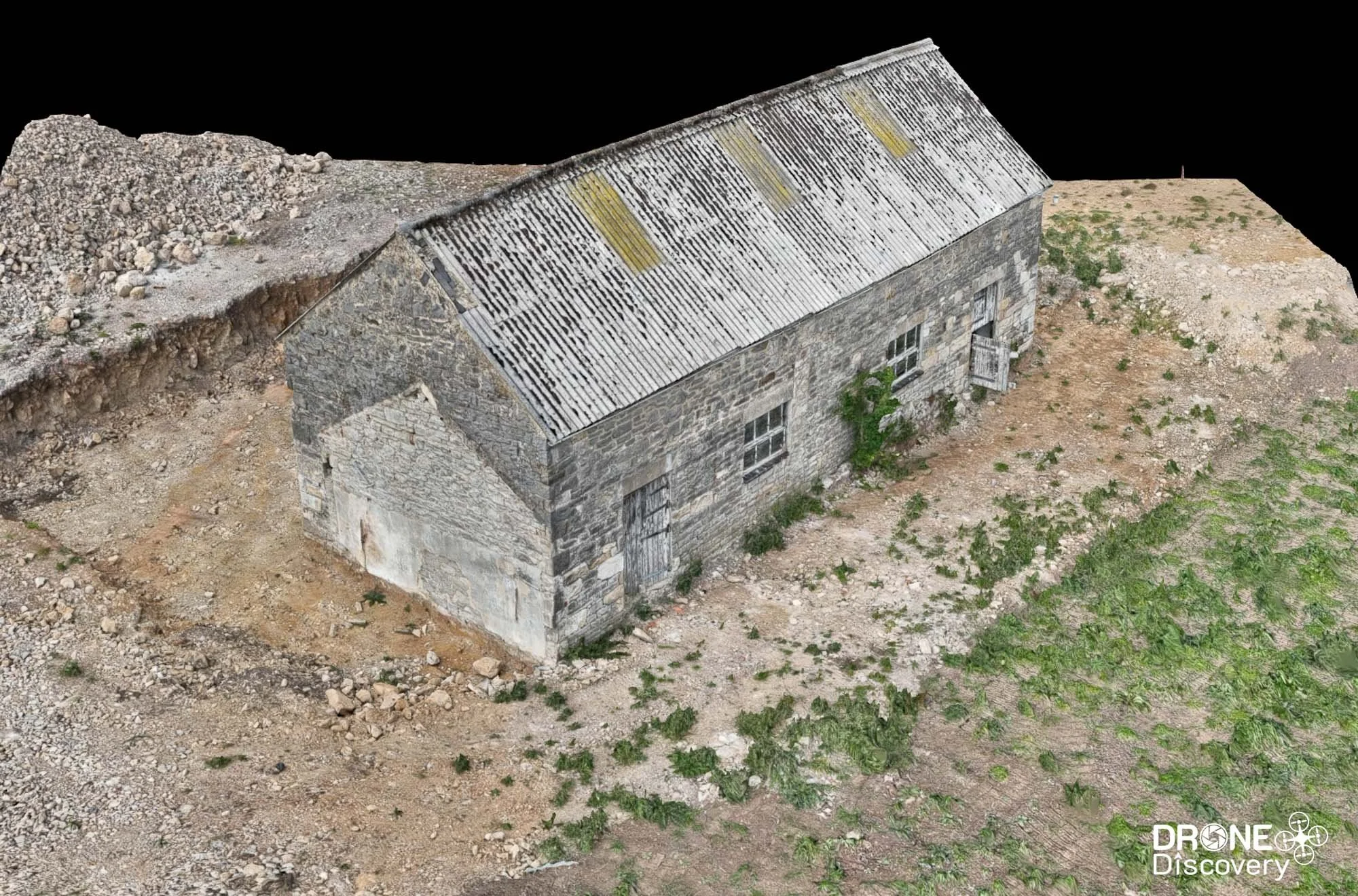
3D model fo Barn
Why Use Drone Discovery for Your Mapping and Photogrammetry Projects?
Expert Pilots and Surveyors: Certified drone operators with experience across industries.
Advanced Equipment: We use cutting-edge drones and sensors to ensure data accuracy and quality.
Fast Turnaround: Efficient processing and delivery of your aerial data and reports.
UK-Wide Coverage: Serving construction, agriculture, environmental, industrial and commercial sectors throughout the UK.
In summary, drone mapping describes the entire aerial surveying process using drones, whereas photogrammetry is the specific image-processing method to convert drone photos into 3D spatial data. Photogrammetry offers a cost-effective, visually rich mapping solution ideal for many applications in construction, agriculture, real estate and more.
By understanding the role of photogrammetry within drone mapping, you can better align your project goals with the right technology, ensuring effective data capture, analysis and decision-making.
Get Started with Accurate Aerial Data Today
Whether you need broad aerial mapping or detailed photogrammetric models, Drone Discovery is your trusted partner for precision drone surveying in the UK