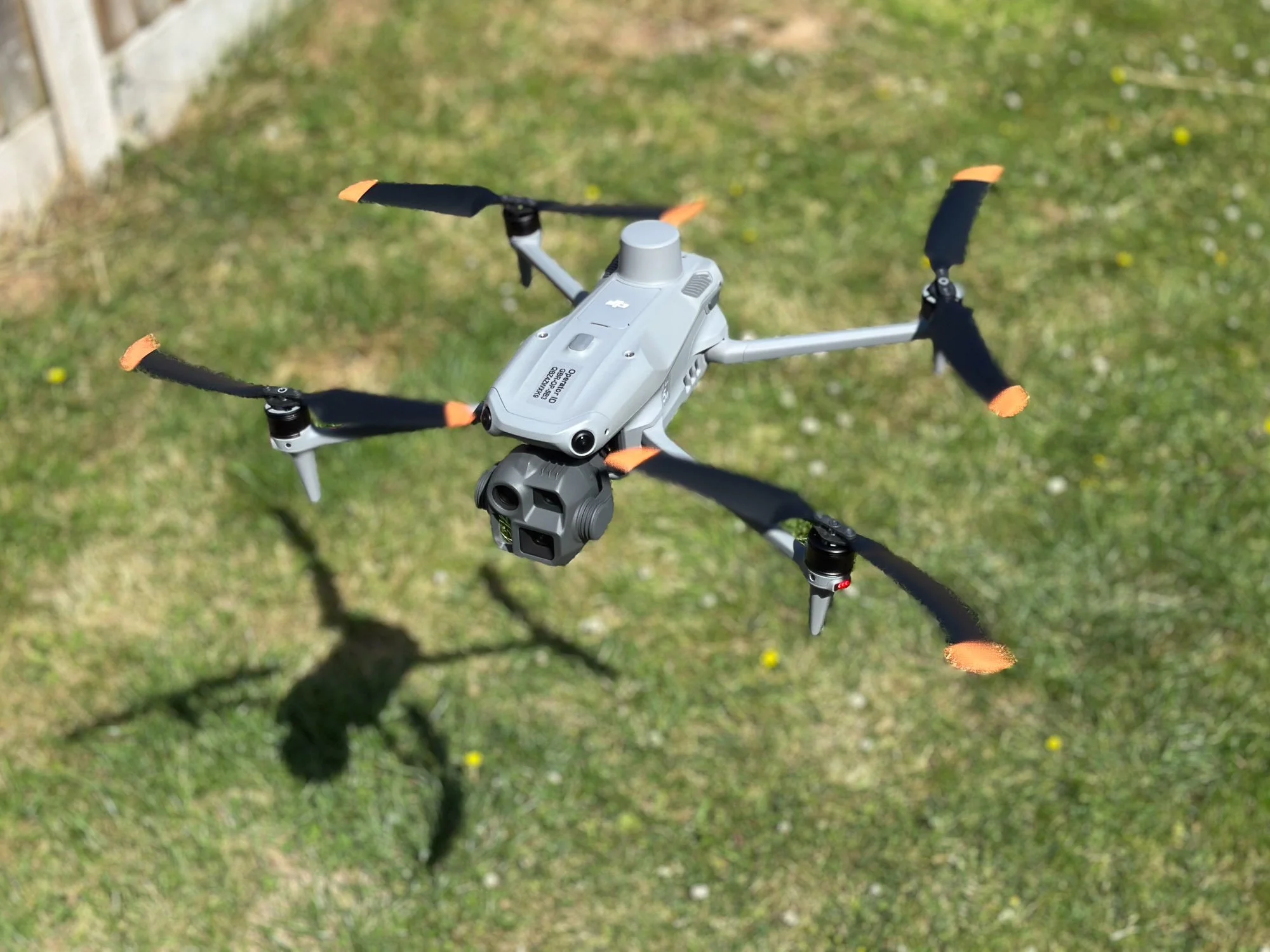
The DJI Matrice 4E: Our Go-To Drone for Reliable Aerial Mapping and Inspections
At Drone Discovery Ltd, we specialise in drone mapping and inspections and we’re committed to using the very best tools for the job. When our clients need aerial data or inspections, reliability and accuracy aren’t optional. That’s why the DJI Matrice 4E, a reliable drone for construction site surveys, 3D modelling, and asset inspections, has earned its place in our fleet. This isn’t just another drone; it’s a professional workhorse that allows us to deliver complex projects efficiently, safely, and to the highest standard. There’s a number of reasons why it’s a game-changer for the services we offer.
Built-in RTK for Survey-Grade Accuracy
One of the standout features of the Matrice 4E is its built-in RTK (Real-Time Kinematic) module. This enables survey-grade positioning accuracy down to centimetres, significantly reducing the need for ground control points. For surveyors and engineers, this means faster deployments, reduced fieldwork, and highly accurate mapping outputs that can be trusted for critical decision-making.
3D Modelling, Surveying & Asset Inspection Capabilities
The Matrice 4E’s adaptability allows us to tackle a wide range of tasks with a single platform. Whether we’re capturing highly accurate 2D mapping and orthomosaic imagery, creating a 3D drone model for buildings, infrastructure, or terrain, or completing asset inspections for roofs, utilities, and industrial equipment, we can quickly switch setups to match the needs of your project.
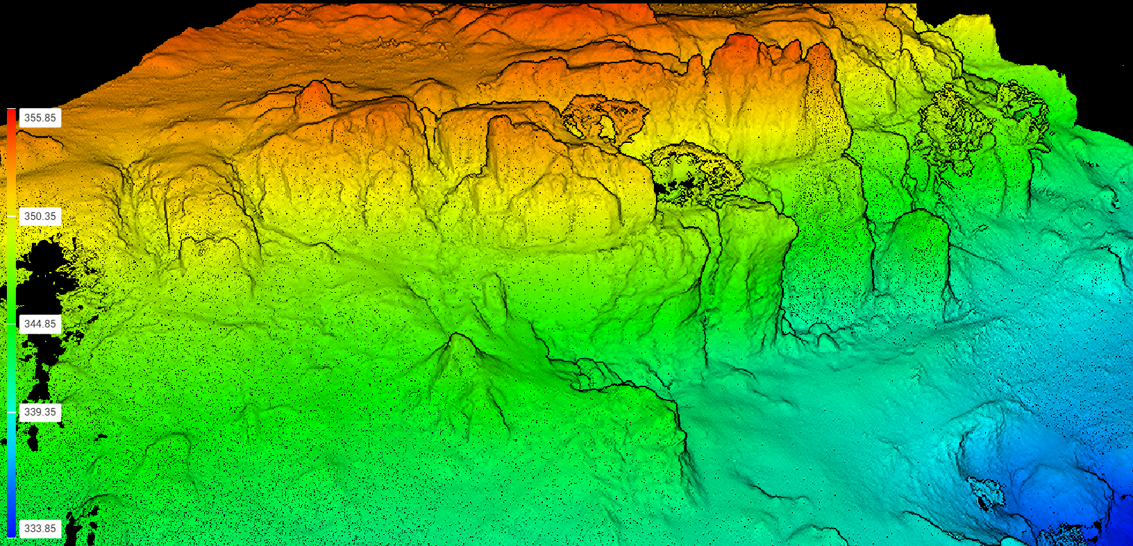
Digital Elevation Model
Its mechanical shutter is a huge advantage for mapping missions, eliminating motion blur and ensuring distortion-free imagery, even when capturing large areas quickly. This translates into more accurate maps and models for surveyors, planners, and engineers.
On top of that, the Matrice 4E can use its own captured data to automatically generate 3D flight missions, allowing us to fly precise, repeatable paths that build the perfect 3D model of a building or area. This automation speeds up workflows and ensures consistency across repeat surveys.
Advanced AI for Smarter Inspections
For asset inspections, the Matrice 4E offers advanced AI features that streamline workflows. Its AI recognition tools can detect, tag, and track objects such as powerlines, rooftops, or structural components, helping us identify issues faster and reduce the time spent manually reviewing data. This is particularly valuable for large or complex sites where precision and repeatability are key.
Seamless Integration with DJI Terra and Beyond
A powerful drone is only as good as the data it delivers. The Matrice 4E integrates seamlessly with DJI Terra and other industry-standard mapping software, ensuring that outputs like orthomosaics, 3D meshes, point clouds, and contour models can be processed quickly and delivered in the formats clients already use. For construction firms, surveyors, and estate managers, this makes adopting drone data straightforward and highly effective.
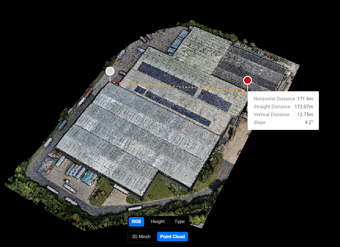
Warehouse point cloud taken with the Matrice 4E and processed in Terra
Extended Flight Time for Large-Scale Projects
With its extended flight time, the Matrice 4E lets us cover larger areas or complete lengthy inspections without constant landings for battery swaps. This means less downtime and more efficient operations, perfect for large estates, sprawling infrastructure, and complex construction sites.
And with advanced obstacle avoidance and redundant safety systems, we can fly with confidence in challenging environments, maintaining the highest standards of safety and compliance with CAA regulations.
Accurate Drone Mapping, Orthomosaics & 3D Models
The quality of the data we capture is where the Matrice 4E truly shines. From high-resolution 2D orthomosaic maps to 3D models, point clouds, and detailed terrain mapping, every output is accurate, reliable, and ready to integrate into your decision-making process.
For site managers, surveyors, and engineers, this means better insights, faster reporting, and early detection of potential issues, all based on dependable aerial intelligence.
Drone Inspections & Surveying Solutions
As more industries adopt drone technology and UK regulations evolve, having access to the right drone for the job makes all the difference. With the Matrice 4E in our toolkit, we can offer a level of service that’s not just about meeting today’s needs, but about future-proofing your operations.
Whether you’re in construction, surveying, inspection, or environmental monitoring, our combination of expert pilots and cutting-edge technology ensures your project is carried out with precision, efficiency, and safety from start to finish.
Contact Drone Discovery Ltd to see how our DJI Matrice 4E drone mapping and inspections can streamline your projects.