
Precision RTK Drone Mapping for Construction: Save Time & Money with Accurate 3D Surveys
Precision RTK drone mapping is transforming the construction industry, providing accurate and efficient surveying solutions that help teams save time and money while delivering high-resolution 3D surveys crucial for successful project delivery. Whether working on infrastructure, commercial sites, or housing developments, the reliability and speed of RTK-enabled mapping are setting a new benchmark for excellence in construction management.
At Drone Discovery Ltd, our expert RTK drone services deliver centimetre-level accuracy, helping you reduce costs and accelerate your build schedule.
What Is Precision RTK Drone Mapping?
RTK, or Real-Time Kinematic, is an advanced satellite positioning technology that significantly enhances the accuracy of drone mapping data. Unlike standard GPS, which often carries a margin of error of several metres, RTK uses correction signals from a fixed base station to reduce that error down to centimetre-level precision. This matters in construction, where the exact placement of earthworks, slab elevations, utilities, and structures is essential for compliance, progress tracking, and dispute avoidance.
With RTK drone mapping, aerial surveys become more dependable and greatly reduce reliance on ground control points (GCPs), which require time-consuming manual layout and measuring across the site. This efficiency is especially valuable on sprawling or hazardous construction sites, where traditional surveying methods can be slow, disruptive, and costly.
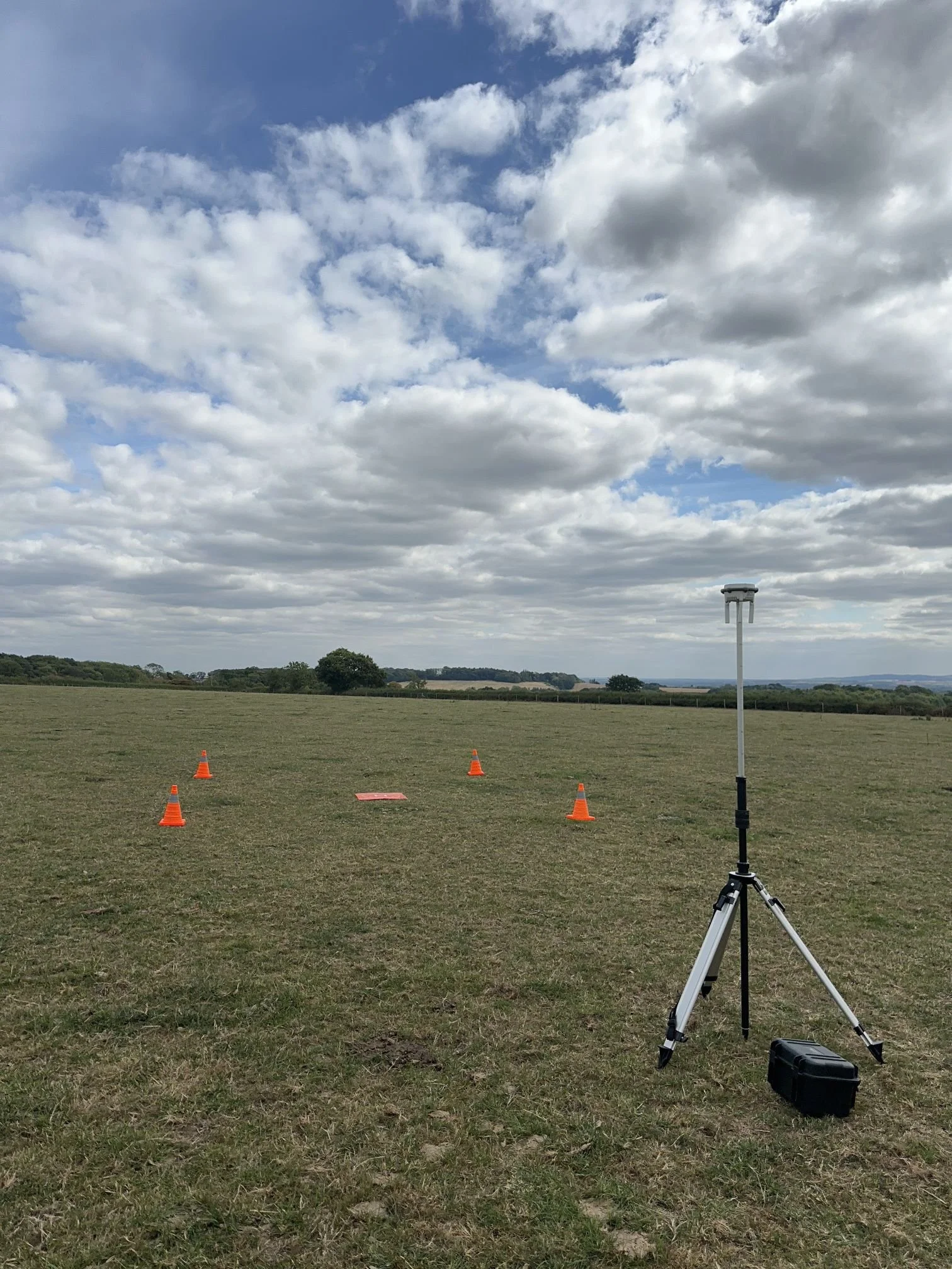
DJI D-RTK3 Multistation
Why Construction Teams Choose RTK Drones
RTK drone mapping offers distinct advantages over manual and non-RTK drone surveys:
Speed: A single RTK drone can scan a 100-acre site in under an hour, compared to a full day for conventional ground surveys.
Cost Savings: Fewer personnel are needed for site surveying, which means reduced errors and improved documentation result in fewer expensive change orders.
Accuracy: With high-resolution outputs and orthomosaic maps adjusted for terrain and lens distortion, teams routinely achieve sub-5cm positional accuracy and 3cm horizontal accuracy on projects.
Safety: Surveyors spend less time on busy, active construction sites, gathering all essentials from the air without compromising safety.
Real-Time Data: RTK drones can upload data instantly to cloud platforms, giving managers and stakeholders immediate access to the latest site conditions, progress photos, 3D terrain models, and measurement reports.
How RTK 3D Surveys Drive Project Success
RTK mapping empowers teams with detailed orthomosaic maps and photogrammetric 3D models that become the backbone of site intelligence. These outputs support multiple workflows:
Verifying earthwork volumes, gradients, and cut/fill operations
Validating slab elevations, utility installation, and as-built documentation
Tracking milestones, worksite changes, and construction schedules
Planning site logistics, haul roads, and crane paths
Providing visual context for design overlays, stakeholder updates, and dispute resolutions
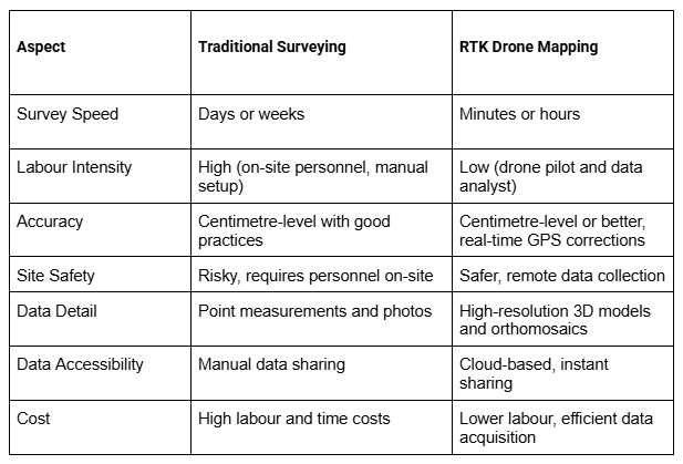
How RTK Drone Mapping Stacks up Against Traditional Surveying Methods
The Future of Construction Surveying
RTK drone mapping is becoming the industry standard for survey accuracy, efficiency, and safety. As drone technology and cloud software continue to evolve, construction professionals will benefit from even more streamlined operations and actionable insights. The ability to rapidly verify progress, detect anomalies, and share data across project teams creates a more transparent, accountable, and productive construction environment.
Choosing RTK drone mapping means empowering your site with the tools to deliver projects on time and with confidence in the data that guides every decision.
Why Choose Drone Discovery Ltd for RTK Drone Mapping Services?
Drone Discovery Ltd offers professional RTK drone mapping services tailored to the UK construction sector. Our expert pilots use cutting-edge RTK/GNSS drones combined with survey-grade software to deliver precise 3D maps, volumetric reports, and progress updates that help your project stay on schedule and budget.
Explore Our RTK Drone Survey Services
Find out how our drone mapping and surveys provide reliable data for construction, civil engineering, and land development projects. Complement your mapping with our aerial photography and drone videography services for comprehensive site documentation.
Contact us on 01332 890 592 or info@dronediscovery.co.uk.